Water levels
The first tab, Water levels, allows the input of the water density as well as the upstream and downstream reservoir levels under normal operating conditions or extreme floods (see Figure 121). CADAM3D treats water levels in the rock. The software assigns, by default, the rock level for reservoir elevations (zero height).
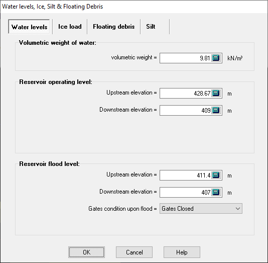
Figure 121